Travel to Iceland
Day 4 Mývatn, Dimmuborgir, Hverir, Viti, Goðafoss (230 Km.)
Lake Mývatn: Lake Mývatn, located in northern Iceland, is a stunning body of water known for its unique beauty and biodiversity. Formed approximately 2,300 years ago by a volcanic eruption, the lake and its surroundings are adorned with fascinating geological formations, such as pseudo-craters and lava fields. This volcanic environment provides an ideal habitat for a rich variety of waterfowl, making it a birdwatcher's paradise. In addition, the region has numerous hot springs, lava caves and natural baths that attract tourists from all over the world. The combination of spectacular scenery and unique natural phenomena makes Lake Mývatn a must-see destination in Iceland.

Skútustadir pseudocraters
Skútustadi pseudocraters: Just in front of our accommodation we had the Skútustaðir pseudocraters. Pseudocraters are a series of unique geological formations that resemble volcanic craters, but formed without eruptive activity. These false craters arose about 2300 years ago due to steam explosions, when hot lava flowed over a swampy area, trapping water and causing steam explosions that created these structures. Their impressive appearance and ease of access have made Skútustaðir a popular tourist destination. Trails around the pseudo-craters allow visitors to explore these natural wonders up close, offering panoramic views of Lake Mývatn and the surrounding area. Compared to our previous visit to this lake, which was in summer, the scenery is totally different, with half of the waters frozen and the surrounding land snow-covered.
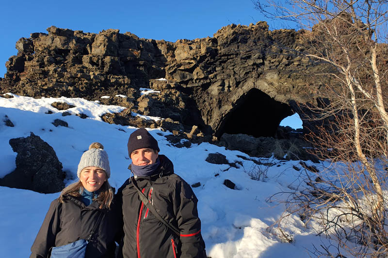
Dimmuborgir - The church (Kirkjan)
(13 Km. away) Dimmuborgir: Dimmuborgir, one of Lake Mývatn's main attractions, is an amazing lava field known for its dramatic and unique rock formations. This "dark castle" was formed some 2,300 years ago during a volcanic eruption, creating a labyrinth of caves, pillars and lava arches that resemble a ruined city. Dimmuborgir's supernatural appearance has fuelled numerous local legends, including tales of trolls and mythical beings. We follow the most popular route, Kirkjuhringurinn, which with a total distance of about 2250 metres leads to Kirkjan, a church-shaped cave. This trail also passes Hallarflöt, a cave that served as a shelter for the shepherds of the area and a natural arch, which together with the "church" is the most photographed spot in Dimmuborgir.
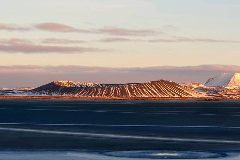
Hverfjall and the frozen Lake Mývatn
(5 Km. away) Hverfjall: Hverfjall, also known as Hverfell, is an imposing volcanic crater on the shores of Lake Mývatn. Formed approximately 2,500 years ago after an explosive eruption, this almost symmetrical crater has a diameter of approximately one kilometre and a height of 396 metres. Its black ash slopes and perfectly circular shape make it a spectacular and distinctive sight in the region's volcanic landscape. Its rim can be ascended via designated trails, offering panoramic views of Lake Mývatn and the surrounding area. We decided to skip this hike and spend our time elsewhere in the area.
(6 Km. away) Grjótagjá: Grjótagjá is a small lava cave near Lake Mývatn, famous for its geothermal hot springs. This cave, with its spectacular rock formations and mystical atmosphere, was historically used as a thermal bath. The waters, which used to be an ideal temperature for bathing, have varied due to volcanic activity in the region, reaching temperatures of over sixty degrees Celsius. The cave became world famous for being featured in the series Game of Thrones
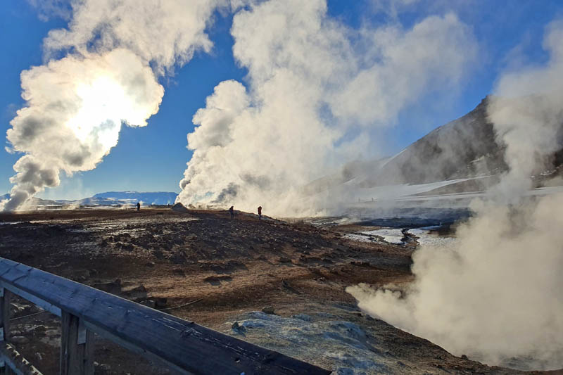
Hverir Námaskarð
(6 Km. away) Hverir Námaskarð: This is a fascinating geothermal area located east of Lake Mývatn in Iceland. This surreal landscape is dominated by bubbling mud pools, steaming vents and sulphur deposits, which stain the terrain in shades of yellow and orange. The smell of sulphur and the constant steam emanating from the earth create an otherworldly atmosphere, similar to the surface of an alien planet. Visitors can walk along marked trails to observe these geothermal phenomena up close, although caution is advised due to the high temperature of the ground. In addition, a 112-metre hike to the top of Námafjall, the nearby mountain, offers a breathtaking panoramic view of the region, allowing travellers to appreciate the vast expanse of geothermal activity from an elevated perspective. We had already made the ascent to the summit on our previous trip and we decided to do without it on this occasion.
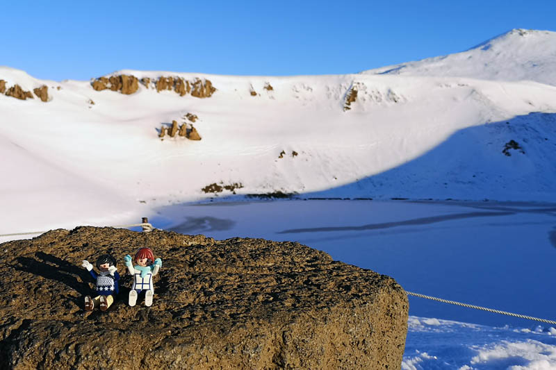
Viti ice crater
(10 Km. away) Viti: Our next destinations were Krafla and Viti, but a short distance from both of them we found that the road was cut off by snow. Given this setback, we only had time to see one of them, walking over the snow. We chose to go and see the Viti crater. Krafla is one of the most active volcanoes in Iceland, known for its impressive crater and geothermal landscape. Viti is an explosive crater that formed during an eruption in 1724. Viti, whose name means "hell" in Icelandic, contains a lake of turquoise blue water that contrasts dramatically with the dark slopes of lava and ash that surround it. On this occasion we were unable to see these colours as the lake's waters were frozen. From the access road to the Viti we could see the steaming caldera of Krafla in the distance.
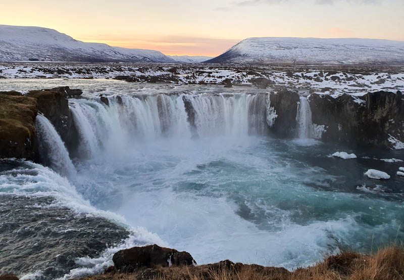
Goðafoss
(63 Km. away) Goðafoss: Goðafoss, known as the "Waterfall of the Gods," is one of Iceland's most impressive and beautiful waterfalls, located on the Skjálfandafljót River in the Norðurland Eystra region. With a height of 12 metres and a width of 30 metres, its waters fall in a majestic semi-circular arc, creating a breathtaking sight and sound spectacle. The waterfall is not only famous for its natural beauty, but also for its historical significance; it is said that in the year 1000, the warlord Þorgeir Ljósvetningagoði threw statues of the Norse gods into the waterfall after declaring Christianity the official religion of Iceland. Trails on both the east and west shores of Goðafoss allow visitors to enjoy panoramic views from several angles, making it a must-see for any traveller on the route between Lake Mývatn and Akureyri.
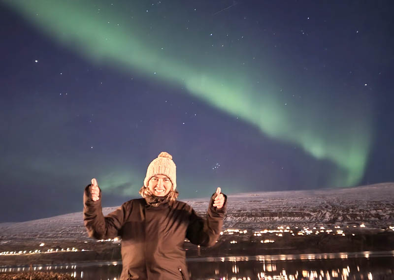
Northern Lights in Akureyri
(35 Km. away) Akureyri: Akureyri, known as the "Northern Capital" of Iceland, is located in the northern part of the country, on the shores of the Eyjafjörður fjord. Just as we arrived there, we were lucky enough, despite the lights, to be able to see the first of the auroras we saw that night over the city's fjord. The aurora borealis, a natural phenomenon also known as the "northern lights", is a celestial spectacle that occurs in regions near the poles due to the interaction of charged solar particles with the earth's atmosphere. These vibrantly coloured lights, ranging from green to pink to violet, are produced when energetic particles collide with oxygen and nitrogen atoms in the upper atmosphere.

Northern Lights
(92 Km. away) Varmahlið: A few kilometres after Akureyri, climbing a mountain pass and without light pollution, we saw nothern lights again. But we saw the most spectacular ones when we arrived at our accommodation. To photograph the northern lights, it is essential to choose a dark location without light pollution, preferably during clear winter nights. Setting up a DSLR camera with a stable tripod and manual settings is crucial: high ISO (such as 800-1600), wide aperture (f/2.8 or lower) and long exposures of several seconds are recommended to capture the dim light of the auroras. Patience and preparation are key, as the auroras can come and go quickly, but capturing the beauty of this unique natural phenomenon rewards you with stunning and memorable images.